Browse Lake District fells and peak guides.
Elevation: 978 m (3,209 ft)
Scafell stands between Wasdale in the west and upper Eskdale to the east. The highest part of the fell is a ridge running south from Mickledore as far as Slight Side, which is counted as a separate fell by most guidebook…

Elevation: 964 m (3,162 ft)
Scafell stands between Wasdale in the west and upper Eskdale to the east. The highest part of the fell is a ridge running south from Mickledore as far as Slight Side, which is counted as a separate fell by most guidebook…

Elevation: 950 m (3,117 ft)
Helvellyn is the third-highest point both in England and in the Lake District, and access to Helvellyn is easier than to the two higher peaks of Scafell Pike and Scafell. The scenery includes three deep glacial coves and…

Elevation: 931 m (3,054 ft)
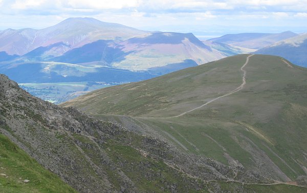
Skiddaw is a mountain in the Lake District National Park in England. Its 931-metre (3,054 ft) summit is the sixth-highest in England. It lies just north of the town of Keswick, Cumbria, and dominates the skyline in this…

Elevation: 910 m (2,984 ft)
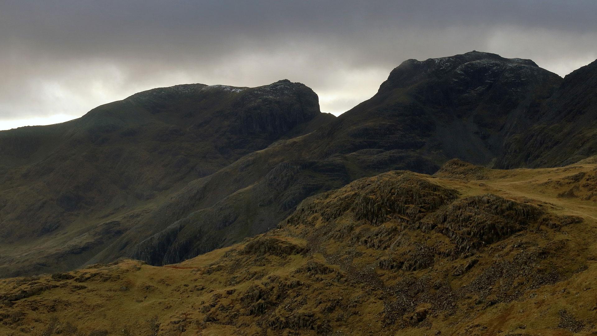
The imposing north-eastern cliffs, riven by gullies, rise some 600 ft from the Esk Hause path. Their orientation ensures that the sun rarely reaches them, the gullies often retaining snow well into the spring. From the l…

Elevation: 903 m (2,962 ft)
Bowfell (named Bow Fell on Ordnance Survey maps) is a pyramid-shaped mountain lying at the heart of the English Lake District, in the Southern Fells area. It is the sixth-highest mountain in the Lake District and one of…

Elevation: 899 m (2,949 ft)
Great Gable is a mountain in the Lake District, United Kingdom. It is named for its appearance as a pyramid from Wasdale, though it is dome-shaped from most other directions. It is one of the most popular of the Lakeland…

Elevation: 892 m (2,927 ft)
Pillar is a mountain in the western part of the English Lake District. Situated between the valleys of Ennerdale to the north and Wasdale to the south, it is the highest point of the Pillar group (some dozen fells cluste…

Elevation: 891 m (2,923 ft)
Nethermost Pike is a fell in Cumbria, England, and a part of the Lake District. At 891 metres (2,923 ft) it is the second highest Wainwright in the Helvellyn range, the highest of which is Helvellyn itself. It is located…

Elevation: 890 m (2,920 ft)
The name of the fell is also given as ‘Catstycam’, a spelling preferred by Alfred Wainwright in his influential Pictorial Guide to the Lakeland Fells. A third variant, ‘Catchedicam’, is also quoted by him. Other guideboo…

Elevation: 885 m (2,904 ft)
To the north-west of Esk Pike is the depression of Esk Hause, a broad saddle carrying a number of important paths. The ‘true’ Esk Hause—so named by Alfred Wainwright in his influential Pictorial Guide to the Lakeland Fel…

Elevation: 883 m (2,897 ft)
Unusually for such a high fell, the slopes of Raise do not have a toehold at valley level on either side. In the west the boundary streams of Sticks Gill (West) and Brund Gill meet just below White Side’s Brown Crag. As…

Elevation: 873 m (2,864 ft)
Fairfield has connecting ridges to several other fells and in plan view can be likened to a bow-tie. The top has an east–west axis with ridges running out north and south from each end.

Elevation: 868 m (2,848 ft)
Blencathra (Hallsfell Top) is a Wainwright fell in the Lake District.

Elevation: 865 m (2,838 ft)
Little Man is often overlooked and disregarded as an independent and distinct fell due to its name which makes it sound like a minor top of its parent fell Skiddaw which in fact lies 1.5 kilometres to the north west. Wit…
Elevation: 863 m (2,831 ft)
Whiteside is a Wainwright fell in the Lake District.

Elevation: 859 m (2,818 ft)
Crinkle Crags (Long Top) is a Wainwright fell in the Lake District.

Elevation: 858 m (2,815 ft)
Explore this Lake District location.

Elevation: 857 m (2,812 ft)
Walkers may approach Great Dodd from either High Row near Dockray to the east, or from Legburthwaite to the west – or along the main ridge track from either north or south. Scramblers with climbing skills may be attracte…

Elevation: 852 m (2,795 ft)
Grasmoor is distinguished by its steep western flank, dropping dramatically to Crummock Water. This face is however not suitable for rock climbers as there is little clean rock, although Alfred Wainwright describes a cha…

Elevation: 843 m (2,766 ft)
The summit of Stybarrow Dodd stands on the main ridge of the Helvellyn range, immediately north of Sticks Pass. This ridge runs north-south for about 11 km without dropping below 600 m. Stybarrow Dodd occupies just over…

Elevation: 841 m (2,759 ft)
Scoat Fell occupies an important position at the crossroads of five ridges. To the east, across the subsidiary top of Black Crag, is Pillar. Southward is a long descending ridge heading toward the shore of Wastwater. The…

Elevation: 841 m (2,759 ft)
St Sunday Crag is the high point on the north-eastern ridge of Fairfield, which runs for two miles before descending to the valley floor behind Patterdale village. From the flat Fairfield summit a rough slope descends ov…

Elevation: 839 m (2,753 ft)
Crag Hill (Eel Crag) is a Wainwright fell in the Lake District.

Elevation: 828 m (2,717 ft)
The Roman road crosses the fell on its journey between the forts at Brougham (Brocavum) near Penrith and at Ambleside (Galava). Situated in one of the quieter areas of the Lakes, the High Street range has quite gentle sl…

Elevation: 826 m (2,710 ft)
The Red Pike ridge occupies a broad area of high country between Nether Beck in the west and Mosedale in the east. The Mosedale face is steeper with considerable areas of Crag, whilst the western slopes descend slowly ov…

Elevation: 822 m (2,697 ft)
Being at the meeting point of three ridges, Hart Crag also has a share in three valleys. Despite forming a part of the headwall in each case, the fell is not the true head of any of them. West of the summit runs the long…

Elevation: 819 m (2,687 ft)
Steeple can be ascended from Wasdale or Ennerdale; it is usually climbed in conjunction with other nearby fells such as Pillar, Scoat Fell and Red Pike as part of the Mosedale Horseshoe walk. It can be climbed directly f…

Elevation: 807 m (2,648 ft)
Although standing in the shadow of its taller parent, Lingmell is very much a separate entity. In the manner of many fells it displays two contrasting aspects. The southern and western slopes– although steep– are smooth…

Elevation: 806 m (2,644 ft)
High Stile is a mountain in the western part of the Lake District in North West England. It is the eleventh-highest English Marilyn, standing 807 metres (2,648 ft) high, and has a relative height of 362 metres (1,187 ft)…